Geography Geography 4 min read

Try not to laugh!

Why? No name? You won’t believe these US towns are called that!

Image: Jeremy Adams

America is home to some truly unique town names… You know, some are charming, some are also confusing , but then again, some make you wonder what exactly the founders were thinking. For example, is Unalaska trying to fly solo? Whether inspired by accidents, geography, or a bit of a je-ne-sais-quoi , these towns prove that creativity knows no bounds. Try to pick a favorite!

1
Unalaska, Alaska

Image: Hari Nandakumar

Despite what the name suggests, Unalaska is not trying to break away from the rest of the state. The town’s name comes from Agunalaksh , the original name given by the Unangan people. Over time, spelling and pronunciation changes led to the simplified version: Unalaska.

In the late 1800s, the US Board on Geographic Names made it official, but don’t worry, it’s just the name; the beauty is certainly Alaskan!

2
Why, Arizona

Image: Kaileen Fitzpatrick

If you’ve ever asked yourself "Why?", you might be thinking too hard. This Arizona town got its name because of a simple road design: State Routes 85 and 86 originally met in a Y-shape.

When it was time to name the community, the locals wanted to call it Y (yes, you read that right), but Arizona law required town names to have at least three letters. So, they got creative and went with Why. Why, right?

3
No Name, Colorado

Image: Rich Martello

What do you call a town when you just can’t decide on a name? Apparently, (and logically, if we might say so), No Name. The story goes that when developers were working on Interstate 70, they left the town’s exit sign blank.

A transportation official later labeled it "No Name", and the locals decided to go with it . State officials tried to rename the area, but the people weren’t having it. They simply loved it!

4
Burnt Store, Florida
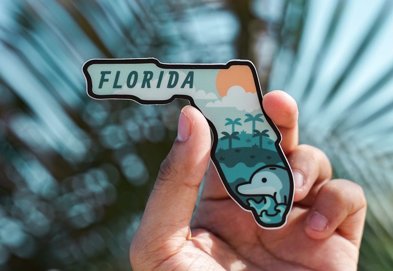
Image: Done By Alex

The name Burnt Store sounds like something out of a Wild West showdown, and the real story (or the legend, actually) isn’t too far off, you know?

Legend has it that in 1849, a trading post on the Peace River was burned to the ground after an attack. The store’s manager, George Payne, had dealings with the Seminole Indians before he was killed in an ambush. Shortly after, the store itself was destroyed. The tragic event left a permanent mark on the town’s history and its name.

5
Santa Claus, Indiana

Image: Ryan De Hamer

Originally called Santa Fe, this town located in Indiana had to change its name when officials discovered another Santa Fe already existed in the state.

People saw this as an opportunity, and instead of picking something new and extraordinary, they went all in on holiday spirit and became Santa Claus in 1856.

The town fully embraces its Christmas identity; it has attractions like Holiday World, Lake Rudolph Campground, and Frosty’s Fun Center. If you love the holidays, this is the place to be!

6
Bald Head, Maine

Image: Michael Denning

If you’re expecting a town full of shiny, bald-headed guys, well, you might be disappointed. Bald Head, Maine, actually gets its name from a nearby cliff called Bald Head Cliff .

Now, we all want to know the same: Does it look like a bald head? Sorry to disappoint, but not really. Still, the name has stuck, and the scenic beauty of the area more than makes up for any confusion. Just don’t show up expecting a bald head convention!

7
Accident, Maryland

Image: Colin Lloyd

Accident, Maryland, owes its name to an actual accident… Well, kind of. In the 1700s, two land surveyors both accidentally claimed the same piece of land without realizing it . One of them, William Deakins, Jr., later allowed the other, Brooke Beall, to keep it. Rather than rename the town, the name Accident stuck. Talk about a happy accident… And generosity!

8
Whynot, North Carolina

Image: Brendan Steeves

Similar to Why, Arizona, this North Carolina town also came about after a naming debate that got a little too long.

Legend has it that settlers were arguing over what to call their new town when one exasperated resident finally said, "Why not just name it Whynot and go home?" And just like that, Whynot was born.

9
Boring, Oregon

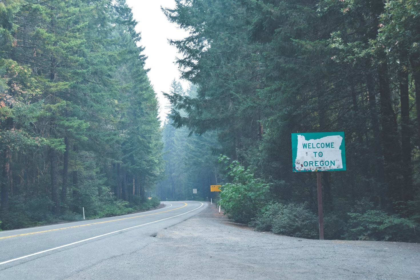
Image: everett mcintire

Yes, we get it. The first thing that comes to mind is "Why would you name your town this?" But despite what the name suggests, Boring, Oregon, isn’t actually boring . If you need some proof, just ask the locals!

Named after William Harrison Boring, one of its early settlers, the town became a hub for the timber industry. To make things even funnier, Boring has international "sister city" partnerships with Dull, Scotland, and Bland, Australia. If you ever visit, you’ll find that Boring is anything but!

10
Mosquitoville, Vermont

Image: Peter James Eisenhaure

If you were reluctant to visit Boring, imagine visiting Mosquitoville! The name alone makes us want to grab a can of bug spray!

Mosquitoville is actually a small community in Barnet, Vermont, and while we can’t confirm just how many mosquitoes live there, the name doesn’t sound very promising. You’ll just have to go one summer and find out! Only if you dare!

Geography Geography 6 min read

Territorial anomalies

There's a country within the US that was created to avoid double taxation

Image: Pin Adventure Map

Ever thought about how the borders in our country were defined ? States that almost became official, U.S. points that are only accessible through Canada's borders, territorial feuds over taxes, and more have constructed the limits of the country we know today. Here are 10 territorial quirks you probably never knew of.

1
Point Roberts, WA: The 49th parallel accident

Image: United States Geological Survey, Public domain, via Wikimedia Commons

Imagine if you had to cross two borders just to get to the market for a gallon of milk. That’s actually a reality for residents of Point Roberts, Washington. That’s because, following the Anglo-American Convention of 1818, the 49th parallel divided Canada and the U.S. In 1846, the line was extended westward and then officially recognized by the International Boundary Commission in 1925.

However, a tiny tip of the Tsawwassen Peninsula poked out just below that line. Since then, the locals have lived in a boundary quirk. To get to the rest of Washington State by land, they must drive through Canada, show their passports, and do it all over again on the way back.

2
Statue of Liberty: Common misconception

Image: Mohamed Osama

If you want to start a friendly argument at a dinner party, ask whether the Statue of Liberty lives in New York or New Jersey. The funny thing is, both answers are technically right . While the statue physically sits in the waters of the Garden State, Liberty Island is legally an exclave of New York. This dates back to a 1664 land grant by the Duke of York in a document so vague and confusing that it took a 1834 Compact between the two states to settle the deal. New Jersey gets the water and the submerged lands, but New York keeps the monument.

However, the Federal Government actually manages the site through the National Park Service (NPS), providing security and maintenance.

3
The State of Franklin: Failed 14th state

Image: Bennett1203, CC BY-SA 4.0, via Wikimedia Commons

If you think Tennessee was the 14th state to join the Union, there’s a catch. Before Tennessee, there was Franklin. In 1874, three counties in North Carolina felt neglected by their government and decided to strike out on their own . They even elected a governor, John Sevier, and printed their own money. They came just two votes short of being recognized by Congress as a formal state. Eventually, things got heated, and North Carolina sent troops, leading to a small civil war between the locals. By 1879, the dream of Franklin was dead and buried, and the territory became part of Tennessee.

4
Kentucky Bend

Image: Brian Stansberry, CC BY 4.0, via Wikimedia Commons

If you look closely at a map, there’s a piece of Kentucky that looks like it doesn’t belong. That’s the Kentucky Bend, also called the New Madrid Bend, a tiny peninsula in Fulton County that is almost completely separated from the rest of the Bluegrass State . The strange situation was the consequence of the massive series of earthquakes that took place in that area between 1811 and 1812, which were so violent they famously caused the Mississippi River to flow backwards for several hours. When the dust settled, the river had carved a new path that looped around this small patch of land, surrounded by Missouri and Tennessee instead of Kentucky. The 9 residents living there today go through Tennessee just to get to their home state.

5
The State of Deseret: The empire that almost was

Image: Carl Radefeld (cartographer); Joseph Meyer (publisher), Public domain, via Wikimedia Commons

Imagine a state so big it makes Texas look tiny. That almost happened back in 1894, when Mormon pioneers proposed the State of Deseret. The territory comprised what we now know as Utah, most of Nevada, parts of Arizona and Colorado, and a massive chunk of the California coast, including San Diego.

Had it been formalized, it would have been a powerhouse with its own seaport and total control over the West. However, Washington, D.C. wasn’t so keen on one group having that much territory and power, so they whittled it down, and we ended up having the states we know today.

6
The lawless "No Man's Land"

Image: Steve Shook from Moscow, Idaho, USA, CC BY 2.0, via Wikimedia Commons

Have you ever wondered what happens when two governments simply give up on a piece of land? Between 1806 and 1821, there was a strip of land in what is now western Louisiana that was, literally, No Man’s Land. Neither the U.S. nor Spain, which owned part of the territory, could agree on the border, so they declared it "Neutral Ground" to avoid armed conflicts . The plan backfired as, with no laws to contain it, it quickly became a favorite for the outlaws in the West —meaning deserters and bandits hiding there were legally untouchable. The conflict was resolved by the 1819 Adams-Onis Treaty, which officially set the Sabine River as the legal boundary.

7
The Republic of the Indian Stream

Image: Jon Platek, CC BY-SA 3.0, via Wikimedia Commons

In the early 1830s, people living in a small area between New Hampshire and Quebec were fed up, and in this case, taxes were the problem. Both Canada and the US were trying to collect taxes, and nobody likes being double-billed . In 1832, the residents essentially said "neither of them can tax us" and formed their own country called the Republic of the Indian Stream. They had their own constitution and Capitol for four years, until 1836, when the militia marched on the disputed territory to reclaim the land. It wasn’t until 1842, when the land dispute and the double-taxation was definitively resolved by the Webster–Ashburton Treaty, which assigned the land to New Hampshire.

8
The Northwest Angle: Mapping mistake of 1783

Image: Lorie Shaull, CC BY-SA 4.0, via Wikimedia Commons

When the Treaty of Paris was signed in 1783 to end the Revolutionary War, the mapmakers used a chart that was flat-out wrong. They thought the Mississippi River started much further north than it actually did. Because of that mistake, a piece of Minnesota got cut off from the rest of the country . To this day, the "Northwest Angle" is the only place in the lower 48 states north of the 49th parallel. Much like Point Roberts, you have to cross a massive lake or drive through Canada just to visit it.

9
The District of Columbia’s "lost" corner

Image: Tim Mossholder

If you look at a map of D.C., you’ll notice it’s missing a chunk; it’s not a perfect square as it was originally intended. Originally, the capital was a perfect ten-mile square diamond , taking land from both Maryland and Virginia. But by 1846, things got tense. Residents in the Virginia portion, which included Alexandria and Arlington, were worried the federal government would abolish slavery in the District, which was the backbone of their economy. They successfully petitioned to have Virginia "take back" that portion of the land and subsequently changed the shape of the national capital forever.

10
UN Headquarters: International territory

Image: LPulecio-WMF, CC BY 4.0, via Wikimedia Commons

If you want to feel international, go to the United Nations Headquarters on the East River in midtown Manhattan, New York. Once you cross that gate onto the 18-acre site, you are technically leaving the United States. You don’t need to show your passport, but that’s international territory, which means it has its own laws , its own security force, and even its own postal service. It is a legal hole in the middle of New York City.

Geography Geography 5 min read

Extraordinary secrets about the capitals of the United States

The only state capital without a McDonald's and 11 other fun facts

Image: AmericanBenchCraft

Can you guess which is the only U.S. capital built on top of an extinct volcano? What about which is the oldest state capital, the least populated, or the one with the coldest temperature? If you're dying to know the answers to these questions, read on to discover 12 fun facts about our state capitals that you probably didn't know!

1
Jackson, Mississippi

Image: Engineers' office, department of Tennessee, Public domain, via Wikimedia Commons

Did you know Jackson, Mississippi, is named after the 7th U.S. President, Andrew Jackson? It is one of the four state capitals named after American presidents —the other three are Jefferson City (Missouri), Lincoln (Nebraska), and Madison (Wisconsin).

Jackson is the only U.S. capital built on top of an extinct volcano. Interestingly, during the Civil War, the city was burned by Union troops, giving it the nickname "Chimneyville". In addition, Jackson is best known for being the center of the civil rights movement during the 1950s and 1960s.

2
Santa Fe, New Mexico

Image: Wendy Shervington

In 1610, Spanish settlers established Santa Fe as the capital of New Mexico, making it the oldest state capital in the country. But that's not the only peculiarity of this quaint city with a temperate climate and a unique historical and cultural richness. At 7,000 feet above sea level, Santa Fe is also the highest U.S. capital.

3
Honolulu, Hawaii

Image: Daniel Lee

Known for its spectacular beaches and rich cultural heritage, Honolulu is the only state capital not on the North American mainland. Considered the birthplace of modern surfing, it also has the highest average annual temperature of any U.S. state capital.

But those aren't the only interesting facts about Hawaii's capital. Here are a few equally (or more) crazy ones: it hosts the only royal palace in the United States (Iolani Palace), the island is made up of volcanic soil, and it houses the world's largest open-air shopping mall (Ala Moana Center).

4
Annapolis, Maryland

Image: Terry Granger

Annapolis is a historic city on the shores of the Chesapeake Bay, known for its colonial architecture, nautical tradition, and academic value. But did you know it is also the smallest U.S. capital by land size? Just 6.7 square miles!

Annapolis was also one of the nine capitals the United States has had throughout its history. For nine months during the Revolutionary War, Maryland's current state capital served as the seat of the Confederation Congress.

5
Bismarck, North Dakota

Image: NASA Astronaut, Public domain, via Wikimedia Commons

If you thought Juneau, Alaska, had the lowest average winter temperature of all state capitals, think again! It's actually Bismarck, North Dakota, where the coldest temperature ever recorded was -45°F. Imagine that!

Bismarck was founded in 1872 on the banks of the Missouri River. The city was named after Otto von Bismarck, the chancellor of Germany, to attract German investors. Another fun fact? In 1930, Bismarck and Fargo had a dispute, known as the "Capitol Tower War," over which city should be the state capital.

6
Charleston, West Virginia

Image: Carol M. Highsmith, Public domain, via Wikimedia Commons

Did you know that the original name of West Virginia's capital was Charles Town in honor of the father of Colonel George Clendenin, one of the first settlers?

Charleston is best known for offering a unique combination of history, culture, and outdoor adventure.

7
Hartford, Connecticut

Image: Balazs Busznyak

Founded in 1635, Connecticut's capital is one of the oldest cities in the U.S. Hartford is known for being a key cultural center in New England. It was the home of writer Mark Twain and is home to historic sites such as the State Capitol, the Harriet Beecher Stowe House, and Bushnell Park, the oldest public park in the country.

Hartford is also called the "insurance capital of the world" due to the presence of major insurance companies. But the city's most curious fact is that it was where Teddy Roosevelt, aboard the Columbia Electric Victoria Phaeton, took the first presidential automobile ride in history!

8
Harrisburg, Pennsylvania

Image: Katherine McAdoo

Pennsylvania's capital city is best known for its role in the Civil War and the Underground Railroad. Located on the banks of the Susquehanna River, Harrisburg has been an important center of transportation and commerce. Today, it is known for its historic architecture, museums, and special events.

Harrisburg is also home to the longest stone arch bridge in the world, the Rockville Bridge, built in 1902. Oh, and in 1979, it came close to a nuclear disaster due to the accident at the Three Mile Island plant, the worst in U.S. history —but that's a longer story for another article!

9
Olympia, Washington

Image: Peter Robbins

Located at the southern tip of Puget Sound, Washington's state capital is known for its natural beauty and vibrant culture. But did you know Olympia is the northernmost state capital in the contiguous U.S.?

Oh, and it's also a great place to try some of the best craft beer in the country.

10
Salt Lake City, Utah

Image: Cong Wang

Utah's state capital is popular for being one of the best places to ski in the United States. But that's not all! Salt Lake City is also the only state capital with three words in its name. Have you ever thought about that?

It has the largest Mormon population in the country and is the world headquarters of the Church of Jesus Christ of Latter-day Saints. Another fun fact? Salt Lake City is home to more plastic surgeons per capita than any other state capital!

11
Montpelier, Vermont

Image: John Holm

Named after the French city of the same name, Montpelier is the least populated state capital, with a population of just 7,900. Probably for that reason, Vermont's capital prides itself on its small local businesses: it is the only state capital that doesn't have a McDonald's or a Starbucks. Could you live without these fast food chains? It doesn't have a Walmart store either!

12
Topeka, Kansas

Image: Nils Huenerfuerst

Topeka, Kansas’s state capital, has several interesting tidbits. For example, did you know its name, of Native American origin, means "a good place to dig potatoes"? Interesting, don’t you think?

In 2010, Topeka temporarily changed its name to "Google, Kansas" to attract the attention of the internet giant and become the capital city of fiber optics. Frivolous facts aside, Topeka was also very important in the history of the civil rights movement.

Explore more American facts

Choose your favorite category!

General
General

As American as apple pie—the very best America has to offer!

Culture
Culture

Delve into the astounding richness of American lore.

Geography
Geography

Hop in and explore vast and diverse American landscapes.

History
History

Discover the key moments that shaped the United States.